Trip type:
Cycle, On foot
What is on the way:
Geocaching
Distance from KV: 9 km
Formation of the Ohře River Valley
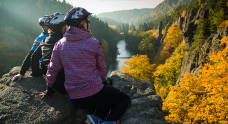
The romantic valley of the Ohře River stretches from Karlovy Vary to Loket and is part of the Slavkov Forest Protected Landscape Area. Less than eight kilometres long, the deep canyon of the valley was created by the Ohře River forcing its way through the Karlovy Vary granite massif. Parts of the left bank are lined with massive rock pillars and pinnacles that formed due to gradual wind and rain erosion of the surrounding high granite walls. In the first half of the 19th century, the valley of the river full of rapids became a popular destination for Karlovy Vary spa guests. Opposite a formation called the "rock town" used to stand a small inn for excursionists, visited often by hackney carriages from Doubí and Karlovy Vary. The inn offered its guests boats to rent.
The path through the valley holds many surprises in store
Marked tourist routes through the surrounding wooded hills start in Loket, Doubí near Karlovy Vary and in Cihelny. A blue tourist route running through the deep valley itself has its beginning in Doubí and, after 9 kilometres, will bring you to Loket. From Doubí you can follow one more trail. It is an educational nature trail with 12 stops offering information from geology, archaeology, history and botany. The 10 kilometre long trail will guide you along the left bank of the Ohře River all the way to the village of Hory where it ends.
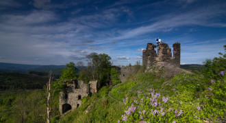
The access to the valley from the Karlovy Vary side is protected by a massive rocky promontory with remains of an early medieval Slavic Starý Loket (Old Elbow) settlement, deserted in the middle of the 10th century. The Tašovice fortified settlement evidences the oldest Slavic settlement in the area. This archaeological site is one of the stops on the educational trail.
Indisputably the most attractive feature of the valley is, however, the Svatoš Rocks (Svatošské skály), a granite rock town formed by rock towers with their distinctive block jointing. In 1933, the rock town was declared a protected natural creation for its uniqueness, and in 2007, it was recognized as The Jan Svatoš National Natural Monument. The Svatoš Rocks offer ideal conditions for climbing. Opposite the Svatoš Rocks, two popular restaurants excursionists wait for you along with a footbridge across the Ohře River known as the "swing bridge".
On your way throughout the Ohře River valley you can see remains of some of the local old mines. Several excavated drifts and slag heaps are located in the steep rocky slopes. It is very likely that the history of the local iron ore and other mineral mining dates back to the early Middle Ages. One of the proofs of the mining activities is the Venetian Gallery (“štola Benátčanů” in Czech) named after Italian prospectors who were intensively searching for deposits of precious metals, minerals and glass materials in the region of Karlovy Vary. The drift is located along the educational trail.
How to get there
The valley is accessible only on foot, by bicycle or canoe. Passenger cars are not allowed to enter. For the best access to the valley from Karlovy Vary, choose the blue tourist route leading off from the district of Doubí. To get to the starting point, use the Bus No. 6. A car park is located on the Doubí periphery. You can also walk through the valley from its other side, from the town of Loket. An intercity bus or train will take you there. Rent a canoe or a raft and go down the river through its rocky canyon all the way to Karlovy Vary. Or you might as well ride your bike on the cycle path running through the whole valley from Karlovy Vary to Loket. It is part of the backbone cycling route No. 204.
Location
Ohře River Valley


